Historical Topographic Map Digitization Project
Preserving Ontario’s Past
The Historical Topographic Map Digitization project was initiated by the Ontario Council of University Libraries (OCUL) Geo Community in 2014. It is a 2.5 year initiative to digitize and georeference early-to-mid 20th century historical topographic maps covering the province of Ontario at the scales of 1:25,000 and 1:63,360. The goal is to create and provide access to high-resolution map scans that preserve historical topographic information and meet the needs of current and future users.
The maps on the home page represent a sampling of the over 1000 maps in the historical topographic maps collection. Please select Full Collection below to view more.


Collection Highlights
Topographic maps can provide historical snapshots that allow you to explore changes to an area over time. Check out the examples below to see how these maps can be used to visualize transforming landscapes, urban areas, and waterways in Ontario.
Old maps are cool! If you are using these maps in an interesting way, we would love to hear from you. Please contact us and let us know how you are using these maps in your own projects.
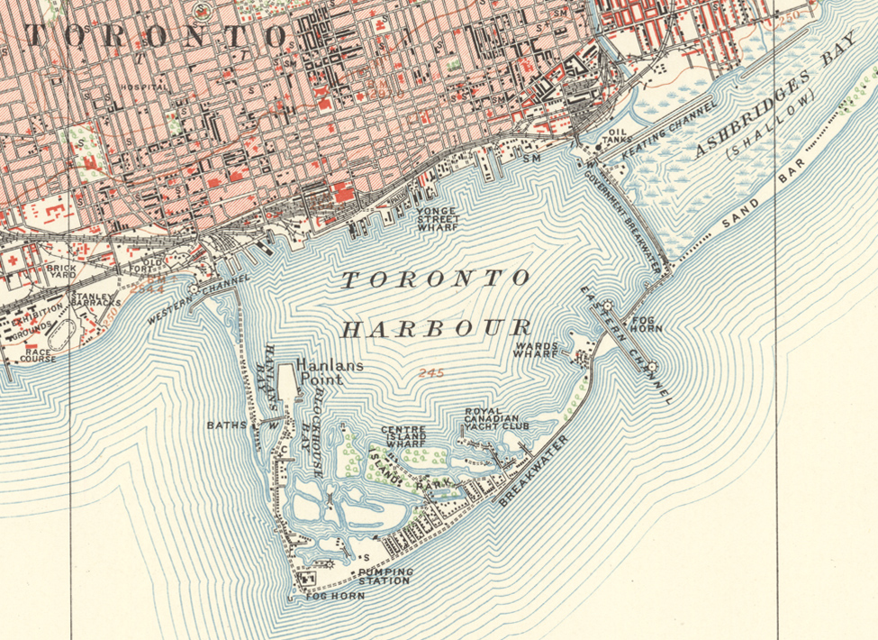
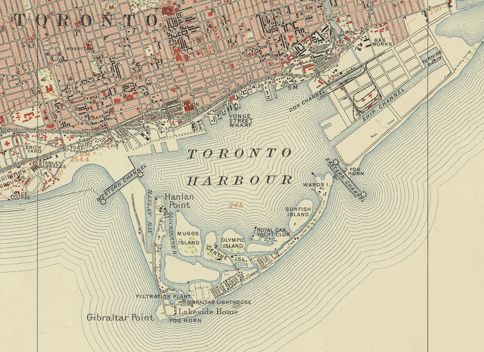
The Port Lands of Toronto
(areas forming the Don River Delta and Ashbridge’s Bay)
Sources
- Toronto, Ontario. 1:63,360. Map Sheet 030M11, [ed. 1], 1909
- Toronto, Ontario. 1:63, 360. Map Sheet 030M11, [ed. 3], 1918
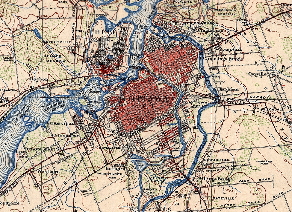
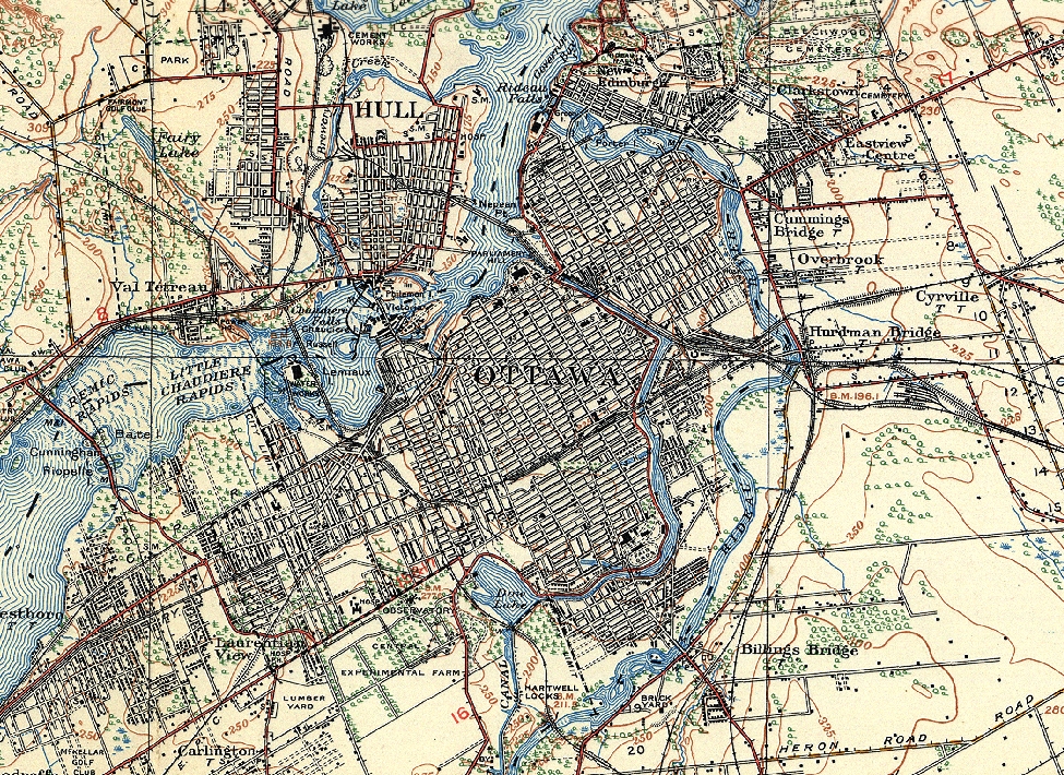
Urban Growth in the Ottawa area
Sources
- Ottawa, Ontario. 1:63,360. Map Sheet 031G05, [ed. 2], 1908
- Ottawa, Ontario. 1:63,360. Map Sheet 031G05, [ed. 10], 1932
Rondeau Provincial Park


Sources
- Ridgetown, Ontario. 1:63,360. Map Sheet 040I05, [ed. 1], 1910
- Ridgetown, Ontario. 1:63,360. Map Sheet 040I05, [ed. 3], gridded, 1941
More information
Rondeau Provincial Park, created in 1894 and located on a sand spit extending into Lake Erie, is the second oldest provincial park in Ontario. The name of the park comes from the French words “ronde eau” or “round water” which describes the shape of the harbour sheltered by the peninsula. Rondeau is home to the largest area of Carolinian forest in Canada, and is an important stopover for birds during migration.